 | ||||||||||||||
|


 |
|
[ Back to Highways Main Page ]
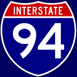 Interstate 94
Total length: 1,604 miles (2,581 km) States traversed & length in each:
Major cities along route:
Junctions with non-related Interstates:
Related loops and spurs:
Length I’ve traveled: From MN Exit 207 (MN 101/Rogers) to eastern terminus Time zones: Counties traversed: A quick hypertext drive: West of Rogers, MN, I have never been on Interstate 94. If you can help me with a description of I-94 across Montana, North Dakota, and the western 207 miles of Minnesota, please e-mail me. In much of the Twin Cities metro area, I-94 is fairly flat with a few very small hills here and there. It generally parallels the western bank of the Mississippi River into the Twin Cities, where it joins and multiplexes with its own “child” route, Interstate 694, for nine miles through the northern suburbs. Just before the river, I-94 breaks off from I-694 and makes a 90° turn to the south, heading directly toward downtown Minneapolis with eight lanes through a largely industrial north-side part of the city. Along the western side of downtown, I-94 enters into the six-lane Lowry Hill Tunnel, a cut-and-cover structure that includes an extremely tight 35-mph (56 km/h), almost 90° curve back to the east. After exiting the tunnel, much of downtown Minneapolis, including the famous Metrodome, is visible north of I-94. A few miles past downtown Minneapolis, I-94 does cross the Mississippi and enters into St. Paul. Back to eight lanes at this point, I-94 passes through some tight curves in downtown St. Paul that necessitate a 45-mph (72 km/h) speed limit. Many of the overpasses in St. Paul feature beautiful decorative wrought-iron railings and other metal works, in a style similar to that seen in downtown Kansas City, MO. Eventually, I-94 exits St. Paul and narrows back to six lanes in the eastern suburbs, before descending a short 4% grade to cross the St. Croix River into Wisconsin. The highway must climb again, for roughly a mile, entering the Badger State. After only a few miles in Wisconsin, I-94 drops back to four lanes again and stays that way for over 200 miles. Up to about Eau Claire, I-94 runs due east-west and is flat, but it enters into much more hilly terrain as it turns away from Eau Claire to the southeast. Eventually, as it nears Tomah and the beginning of a 93-mile multiplex with I-90, I-94 flattens out a bit. Along this multiplex, it is I-90’s exit and mile numbering that is maintained, meaning eastbound travelers jump down from I-94 mile 147 to I-90 mile 45 at the Tomah end of this pairing. The path of I-90/94 remains slightly hilly, although not as much so as I-94 northwest of Tomah, through west-central Wisconsin. Near Wisconsin Dells, the highway approaches the Wisconsin River valley and flattens out somewhat; a few of the major Dells-area resorts sit literally right next to the highway’s path. Continuing to the southeast, I-90/94 passes by the Cascade Mountain Ski Area, visible on the south side of the road, and south of Portage, joins with Interstate 39 for a “triple multiplex” down to Madison. Just after the merge occurs, I-39/90/94 becomes six lanes and crosses the Wisconsin River very shortly thereafter.
The highway turns almost to due south and enters into a fairly flat area. Much of the route of I-39/90/94 is rural, but along the north side of Madison, it starts passing some “edge” developments (mostly industrial parks) and even goes past some suburban-style office parks along the east side of Madison. A few miles due east of downtown, I-94 finally breaks away from its long multiplex and resumes its own alignment, heading east for Milwaukee while Although the areas around Lake Mills and Oconomowoc seem almost suburban in character when viewed from I-94, the highway does not resume six lanes again until it approaches Waukesha, on the western edge of the Milwaukee metro area. At milepost 302, just before entering Milwaukee County, I-94 comes down a mile-long 4% grade into the Lake Michigan basin. Approaching Milwaukee from the west, I-94 passes by Miller Park, the home of baseball’s Milwaukee Brewers, and upon reaching downtown, it makes a 90° turn to the south through the elevated Marquette Interchange. Much of I-94 through downtown Milwaukee remains elevated above grade, at least until the highway leaves the downtown area to the south.
Multiplexing with Interstate 43 to the south of downtown, I-94 comes to a 50-mph (80 km/h) curve to the west. Very shortly thereafter, I-94 turns back to the south and hands
Twenty-four miles into Illinois, I-94 leaves the Tri-State Tollway (which becomes I-294 at this point) and follows the Tollway’s four-lane “Edens Spur” over to the Edens Expressway, passing through a toll plaza along the Spur. After five miles on the spur, I-94 joins the six-lane Edens, which is notorious for its horrendous reverse rush-hour congestion (that is, congestion is worst headed away from Chicago in the morning, and headed into Chicago in the evening), to head through the northern suburbs. One factor keeping the inbound Edens as congested as it is would be the under-powered merge with the Kennedy Expressway The Kennedy Expressway carries eight general-purpose lanes that are always open, plus a pair of reversible express (fewer exits) lanes in the median. The reversibles are open to inbound traffic from 1:00 am to 11:00 am, then close for two hours to ensure a safe conversion to outbound travel; they re-open for this outbound traffic at 1:00 pm and remain open until 11:00 pm, closing for another two hours for the change back to inbound travel. (This pattern can be changed in cases of unusual traffic-flow circumstances.) As these reversible express lanes end, I-90/94 enters the Chicago Loop and passes through “Hubbard’s Cave,” a long section where the freeway passes underneath a couple blocks of the city. At the “Circle Interchange” with I-290/Eisenhower Expressway, I-90/94 becomes the Dan Ryan Expressway and widens to 10 lanes for a short stretch, heading up onto an elevated alignment paralleling the southern part of the downtown area. Carrying a 45-mph (72 km/h) speed limit, the Ryan goes through a pair of tight curves as it interchanges with I-55/Stevenson Expressway; immediately after this interchange, a 14-lane express-local configuration (three local and four express lanes each way) begins. U.S. Cellular Field, the home of baseball’s White Sox, sits next to the Ryan as it heads toward the South Side.
Eight miles south of the Loop, I-90 leaves the Ryan and follows the Chicago Skyway into Indiana; I-94 remains on the Ryan, but the express-local configuration ends and the Ryan narrows to eight lanes. Four miles further south, I-94 curves to the east and joins the Bishop Ford Freeway, a six-lane north-south highway through the south suburbs, following it to the interchange with I-80, I-294, and Illinois Route 394 in Lansing; at this interchange, At the Indiana state line, the Kingery Expressway changes its name to the Borman Expressway, and I-80/94 widens to eight lanes on a recently-rebuilt section of freeway. The highway narrows back to six lanes at the I-65 interchange southeast of Gary, and five miles later, I-80 leaves I-94 to go join I-90 on the Indiana Toll Road. Continuing on by itself, I-94 heads through the easternmost reaches of Chicagoland and passes to the south and east of Michigan City before entering the state of Michigan. Six lanes are maintained for the first 34 miles in Michigan, up to the Interstate 196 interchange; at this point, I-94 narrows back to four lanes. Much of I-94 in Michigan was built as a U.S. Route 12 freeway in the 1950s, and there are several substandard stretches that really show their age today; in particular, a segment east of Kalamazoo has narrow left shoulders and a narrow concrete-barrier median, and a stretch in Jackson has no left shoulders at all and carries a 55-mph (88 km/h) speed limit. A six-lane stretch starts at milepost 166, but just as quickly disappears five miles later at the M-14 interchange. The four-lane section around the west and south sides of Ann Arbor is in desperate need of being widened to six lanes with the traffic volumes it carries; in fact, the same can be said of much of four-lane I-94 in Michigan. Most of the route in Michigan is flat, but there are some low rolling hills here and there. Just after the interchange with the U.S. Route 23 freeway southeast of Ann Arbor, I-94 widens to six lanes and remains at six for 63 miles, all the way through the Detroit metro area. A pair of tied-arch bridges in the suburb of Taylor are designed to act as a “gateway” to Detroit for visitors coming into the city from its airport; these bridges, which were part of a 2004-05 interchange reconstruction at U.S. Route 24/Telegraph Road, are admired by some locals and derided as wasteful by others. A reconstruction of I-94 through the western suburbs was also undertaken around this same time frame, and the old pavement, notorious for its pothole-ridden rough ride, is no more. Unfortunately, I-94 never does widen beyond six lanes all the way through the city of Detroit. Particularly in the city itself, this 1950s-era alignment is horribly substandard; left shoulders don’t exist, and there are no acceleration and deceleration lanes on any of the ramps. The estimated $1 billion cost to rebuild I-94 on Detroit’s west side as a modern eight-lane freeway has held the project up for years. On the east side of the city, I-94 begins to slowly turn to the northeast and eventually to the north, passing through the northeastern suburbs of Macomb County on its way toward Port Huron. At milepost 243, I-94 narrows back to four lanes for the final time; from there to Port Huron, the highway passes through a flat, rural area. Just west of Port Huron, I-94 is joined by I-69, and together, the two highways pass south of Port Huron and terminate upon reaching the Blue Water Bridge, a Canadian border crossing to Sarnia, Ontario. |