 | ||||||||||||||
|


 |
|
[ Back to Highways Main Page ]
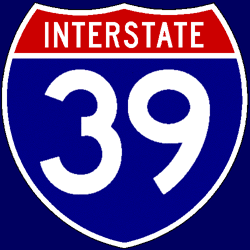 Interstate 39
Total length: 323 miles (520 km) States traversed & length in each:
Major cities along route:
Junctions with non-related Interstates:
Related loops and spurs:
Length I’ve traveled: Entire length Time zones: Counties traversed: A quick hypertext drive: Much of the current routing of I-39 follows the pre-existing (and still multiplexed) route of U.S. Highway 51, with only a few exceptions in Wisconsin — and even there, I-39 was simply designated concurrently with existing routes or as a replacement for an older route designation, meaning there was no actual new construction involved in its creation. The route through Illinois passes through flat farm lands for the most part, with the exception of an impressive bridge over the Illinois River, and the Rockford metropolitan area. Just south of Rockford, I-39 joins I-90, which is a toll road for most of its length in Illinois; hence, I-39 is a tolled route up to the Wisconsin state line. The two stay joined for almost 80 miles in Wisconsin up to Portage, with I-94 joining at Madison to form a 29-mile “triple multiplex” (I-39/90/94) — one of only two triple concurrencies on the Interstate system, and by far the longer of the two (I-55/64/70 in St. Louis, MO and East St. Louis, IL is three miles long). At Portage, I-39 breaks off of I-90/94 and follows the former State Trunk Highway 78 bypass to the east of the city; this eight-mile stretch is the only portion of I-39 that is not concurrently designated with any other highway. (Interestingly enough, the Wisconsin Department of Transportation (WisDOT) did not erect I-39 signs on this segment for many years after I-39 was designated; signage read “TO US 51” on the northbound side, and “TO I-90/94” going south, after the STH-78 signage was removed.) From the I-90/94 split all the way to its northern terminus at Wausau, I-39’s roadside mileposts do not correspond to the actual mileage of I-39 in Wisconsin — the mileposts are all roughly five miles too high, because they match up with Wisconsin’s routing of U.S. 51 instead. The route becomes slightly more hilly in Wisconsin, particularly just south of Madison and also near the Wisconsin River crossing just south of Portage, before flattening out again until just south of Wausau. Despite the fact that the road continues as a freeway for another 25 miles northward, to the town of Merrill, I-39 terminates at its southern junction with State Trunk Highway 29 south of Wausau, and gives way to the U.S. 51 designation. |