 | ||||||||||||||
|


 |
|
[ Back to Highways Main Page ]
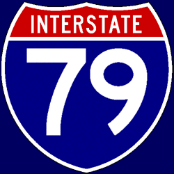 Interstate 79
Total length: 343 miles (552 km) States traversed & length in each:
Major cities along route:
Junctions with non-related Interstates:
Related loops and spurs:
Length I’ve traveled: From southern terminus to PA Exit 116 (I-80); from PA Exit 178 Time zones: Counties traversed: A quick hypertext drive: Interstate 79 exists primarily to provide a north-south connection to the rest of the Interstate system for eastern West Virginia and western Pennsylvania, including the Pittsburgh metropolitan area. It also serves as part of an alternate route, bypassing the tolled Pennsylvania Turnpike, from the central part of the country to the Mid-Atlantic region. It begins three miles northeast of downtown Charleston, WV, and almost instantly enters the mountainous terrain that characterizes much of central and eastern West Virginia. For almost 60 miles (about 95 km) out to Sutton, WV, I-79 actually runs almost exactly east-west rather than north-south. After the U.S. Route 19 interchange, I-79 turns to the north-northeast, staying in the mountains and heading for Morgantown. As it is a mountain freeway, I-79 does have some tight curves and long and/or steep grades, but none of them are especially dangerous or notorious for large numbers of accidents. The highway and the terrain do flatten out a bit north of about Fairmont, but the surroundings do remain hilly through Morgantown and well beyond. Just past Morgantown, I-79 enters Pennsylvania; the 34 miles (56 km) up to the eastern Interstate 70 interchange run almost literally through the middle of nowhere. That interchange, just east of the city of Washington, PA, is notorious for frequent and often serious accidents between full-speed traffic on westbound I-70 and 25-mph traffic following the ramp that joins northbound I-79 with westbound I-70. Four miles to the northwest, I-79 leaves I-70 and heads toward Pittsburgh; it doesn’t actually serve the city, instead spawning a “child” route, Interstate 279, to do so. There are a couple of nasty 45-mph (72 km/h) curves to negotiate just before I-79 crosses the Ohio River. A new direct connection to I-76/Pennsylvania Turnpike opened in 2004; traffic no longer has to follow U.S. Route 19 through Cranberry Township to transfer between I-76 and I-79. For the most part, the last remaining 100 miles (161 km) of I-79 feature hilly terrain, with a few relatively flat sections further north. The highway actually ends at Pennsylvania State Route 5 just west of downtown Erie, not at I-90; originally, I-79 was planned to end at I-90 and the resulting stub was to be numbered I-179, but this plan was scrapped later as I-79 was being built. |