 | ||||||||||||||
|


 |
|
[ Back to Highways Main Page ]
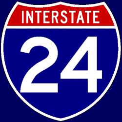 Interstate 24
Total length: 316 miles (508 km) States traversed & length in each:
Major cities along route:
Junctions with non-related Interstates:
Related loops and spurs:
Length I’ve traveled: Entire length Time zones: Counties traversed: A quick hypertext drive: Interstate 24 breaks off from Interstate 57 in far southern Illinois, and spends more time running north-south than east-west through the hill country near the Ohio River. Once it crosses the river, I-24 curves around to the east as it bypasses Paducah; this stretch is flat and fairly boring. After the junction with the Purchase Parkway, I-24 crosses the Tennessee and Cumberland rivers; Land Between the Lakes National Recreation Area is just south of I-24 at this point. I-24 turns slightly to the south after the Western Kentucky Parkway splits off. The terrain is flat to slightly rolling through much of the rest of Kentucky and into Tennessee; perhaps 20 miles before Nashville, it suddenly becomes much more hilly. After a short multiplex with I-65 just north of Nashville, I-24 provides the best views of — and perhaps the best access to — downtown Nashville; LP Field, the home of the Tennessee Titans, stands only yards off the freeway. I-24 merges with, and then splits from, I-40 just east of downtown. After the split from I-40, I-24 is eight lanes wide all the way out to the Tennessee Route 840 interchange near Murfreesboro; however, just before the interchange, it very quickly narrows to four lanes. (It is being widened for a few miles beyond TN 840 as of summer 2005.) Again running slightly more north-south than east-west, I-24 enters hilly terrain beyond Murfreesboro. The Jack Daniel’s whiskey distillery, a favorite attraction of liquor connoisseurs, can be accessed by exiting I-24 in Manchester. At roughly mile marker 130, I-24 starts to climb Monteagle Mountain (going east); this stretch is only four lanes wide, meaning there is no slow-vehicle lane in either direction. After four miles of a 5% climb, the highway passes the town of Monteagle, staying on the plateau for about two miles before a dramatic four-mile 7% descent. On the eastern face of the plateau, I-24’s westbound lanes are separated from the eastbound lanes by more than a mile; the two directions go around different sides of the mountain. (There is a slow-vehicle lane in both directions — climbing westbound, descending eastbound for heavy trucks — on the eastern slope.) Once past Monteagle Mountain, I-24 passes through an area of southeastern Tennessee with beautiful mountain and lake scenery, although the highway itself is at most slightly hilly. Not long thereafter, I-24 dips south into Dade County, Georgia, for four miles; Raccoon Mountain prevented the construction of an alignment entirely within Tennessee. I-59 terminates at I-24 along this short Georgia stretch before I-24 re-enters Tennessee. The exit numbering along this Georgia stretch of I-24 is carried over from Tennessee; it does not reset to zero at the western crossing into Georgia, and the two exits in Georgia are numbered 167 and 169. However, I-24’s mile markers do reset to zero in Georgia, and the Georgia Department of Transportation (GDOT) is responsible for construction and maintenance of this part of I-24; the exit numbers are the only thing that doesn’t change in Georgia. Upon re-entering Tennessee, the mile markers immediately jump back to 171, meaning that Tennessee mile-marks its eastern segment of I-24 as if it had never left the state. Several miles after re-entering Tennessee, I-24 runs along the shore of the Tennessee River approaching downtown Chattanooga. There are a few sharp, slow curves and one more climb/descent combination (called East Ridge) before I-24 terminates at I-75. Drivers headed west into Chattanooga are treated to a scenic, panoramic view of the city as they reach the top of East Ridge and start heading down the hill. |